Skip over navigation

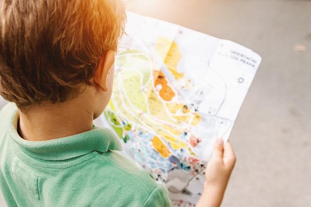
Children often enjoy following familiar and new routes, finding locations and making maps.
Adults could provide maps to follow and map-making materials such as large or long pieces of paper, clipboards and pens.
 Resources
Acknowledgement: James Gray and the Reception Class at St Leonard's Primary School, Stafford
Or search by topic
Number and algebra
Geometry and measure
Probability and statistics
Working mathematically
Advanced mathematics
For younger learners
Mapping
Age 3 to 5
Experiencing and talking about position and direction
Interpreting and representing spatial relations with 2D plans, pictures and symbols
Interpreting and representing spatial relations with 2D plans, pictures and symbols


Children often enjoy following familiar and new routes, finding locations and making maps.
Adults could provide maps to follow and map-making materials such as large or long pieces of paper, clipboards and pens.
The Activity
Take the children on a walk in the local environment. Together, note landmarks to help to remember the route and take photos. Afterwards, invite the children to recall the route (the sequence of landmarks and turnings) and together make a simple map with photographs. Invite children to repeat the route following the map.
Take the children on a walk in the local environment. Together, note landmarks to help to remember the route and take photos. Afterwards, invite the children to recall the route (the sequence of landmarks and turnings) and together make a simple map with photographs. Invite children to repeat the route following the map.
Encouraging mathematical thinking and reasoning:
Describing
When walking and recalling the route, use position words (e.g. next to, between, in front of, opposite), directions (across, left, right) and sequencing words (e.g. before, after, next). What did we see after we went across the road?
When walking and recalling the route, use position words (e.g. next to, between, in front of, opposite), directions (across, left, right) and sequencing words (e.g. before, after, next). What did we see after we went across the road?
Reasoning
Put photographs in the wrong order for the children to correct. How do you know that this is in the wrong place? What should it be next to?
When following the map, ask, How do you know we are going the right way? How do you know which way to go now? What do you think we will see next?
Put photographs in the wrong order for the children to correct. How do you know that this is in the wrong place? What should it be next to?
When following the map, ask, How do you know we are going the right way? How do you know which way to go now? What do you think we will see next?
Opening Out
Provide a new map of a route for the children to follow, with different landmarks to spot, and challenges of turning left and right.
Introduce symbols instead of photos, perhaps agreeing together on which symbol to use for a specific type of landmark (choosing simple ones that are easy to draw).
Make maps of routes indoors and outdoors, with photos or symbols.
Recording
Children can draw or place symbols or photographs to create their own maps of familiar routes, such as from home to school, tracing the route with a finger to show the way that they went. Children might enjoy discussing their maps with their family.
Children can draw or place symbols or photographs to create their own maps of familiar routes, such as from home to school, tracing the route with a finger to show the way that they went. Children might enjoy discussing their maps with their family.
The Mathematical Journey
Shape, space and position:
- recalling, visualising and predicting simple routes
- understanding and using positional language e.g. next to, between, opposite; relative terms e.g. in front of, behind; and directional language e.g. across, through, left, right
Measures:
- sequencing and using time words, e.g. first, next, then, before, after
- comparing distances, using comparative language, e.g. nearer, further
- counting steps to measure distances between things
Development and Variation
- Take photographs of places on familiar routes (such as classroom to the dinner hall or the school to the local shop) for sequencing and map making.
- Provide large rolls of paper for children to collaboratively draw maps using felt-tipped pens. Encourage children to make scale models of rooms, gardens or local areas, with drawn roads, paths and walls: toys such as cars, people and animals will help them to think about scale.
- Draw simple maps to show children where a toy or treasure is hidden. Point out symbols to help them identify their position in relation to that of the object.
- Create a map of a journey made by a book character, to help them find their way back.
- Read books about maps and journeys e.g.
- Henry’s Map by David Elliot,
- A Lion in the Night by Pamela Allen
- Lucy in the City by Julie Dillemuth
- Share maps of the area, the world or plans of the school (including aerial photographs and interactive online maps where you can zoom in on specific locations). Identify important landmarks and talk about their position in relation to other landmarks.
 Resources
- Camera and printer to make photos, symbols and maps
- Paper (including large sheets and long rolls) and pens to make maps
- Small world toys, buildings, furniture, trees, fences etc.
- My map book by Sarah Fanelli
- As the Crow Flies: A First Book of Maps by Gail Hartman
- Follow That Map: A First Book of Mapping Skills by Scot Ritchie
Download a PDF of this resource.
Acknowledgement: James Gray and the Reception Class at St Leonard's Primary School, Stafford


